Not every street should be the same - a good development provides a range of street types. A clear hierarchy of streets helps create a place that is legible and easier to navigate (we instinctively understand the difference between a main road and a side street) and allows for variety and distinctiveness.
Each street type within a hierarchy will have a different balance of 'movement' and 'place' functions - from the principal routes with high vehicle movement, to tertiary streets that limit access to through traffic and maximise amenity. All streets need to be designed as places - even those designed to move large volumes of traffic.
Through good use of a street hierarchy, it is possible to create places that balance convenience and access for vehicles with amenity and space for people.
The Better Streets for Lincolnshire typologies simplify the design of street networks. They provide a pattern book of street types, each with defined characteristics, such as width, setbacks, materials, planting, parking, and with good placemaking principles baked in.
There are three main typologies:
For the purposes of this code, 'trunk roads' are defined as those that perform a key strategic movement function within the local or wider area (including principal A-roads). They are defined by their role in the network rather than their designation as part of the Strategic Road Network.
The choice of street type will be informed by the size of the development and the street's position within the wider network. For example, a Principal street must always connect to other Principal streets or the trunk road network. Residential streets will normally connect from Principal streets to other Residential streets, and so forth.
Given the size of most developments in Lincolnshire, the majority of new streets are expected to be Residential and Tertiary streets.
Refer to Part A - Planning Better Streets for further guidance on creating a network.
All new streets that will be adopted must be in accordance with the Better Streets typologies, unless agreed otherwise at the pre-planning stage.
The diagrams below show examples of the 'Better Streets hierarchy' applied to the developments of varied scales.
It is recognised that not all eventualities are covered by the Better Streets typologies. Some developments, such as strategic urban extensions (SUEs), will require high streets and other typologies not present here. Some designers may wish to innovate and go beyond the basic requirements of Better Streets, or bring in examples that have worked elsewhere. We welcome ambitious proposals, and are open to discussing and agreeing deviations from these typologies at the pre-application stage.
However, for the majority of sites, the simplest route to approval and adoption is use of the Better Streets typologies set out in this chapter.
Developers can propose variations on, or alternatives to, any of the better streets typologies at the pre-application stage, and subject to agreement.
Any alternatives or variations must demonstrably deliver equal or better outcomes than Better Streets typologies in terms of highway safety, accessibility and placemaking.
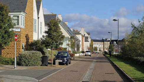
Principal Streets act as the main access route for larger developments. They have the highest movement function - for vehicles and people, and typically link the development to other Principal Streets or the trunk road network, and connect to Residential streets. They still have an important place function, and due to their high connectivity can accommodate shops, cafes, schools and other community facilities. Their movement function includes cyclists and pedestrians and as such have wider footways and segregated cycle tracks.
The following sections and diagrams show typical arrangements and dimensions for Principal Streets:
The key design characteristics and requirements are as follows
| Carriageway Width (excluding cycle lanes) | 5.5 m - 6.0 m (single) 11.0 m - 12.0 m (dual) Excludes any central reservation |
|---|---|
| Verge | Mandatory if no kerbside swale or parkingOptional with parking Minimum width: 1.5 m min |
| Drainage | Mandatory SuDS - combination of:
|
| On-street parking | Optional with verge / swale (either side)Mandatory without (either side) Minimum width:
|
| Cycle lane & buffer | Mandatory unless off-street route is provided. Minimum 1.5 m (1 direction) and 2.5 m (2-direction) Add +0.5 m min buffer (against parking or carriageway |
| Pavement | 2.5 m minimum (both sides) |
| Central reservation, or island features | Optional Minimum widths:
|
| Design Speed (not limit) | 20 mph |
| Total adoptable corridor width (approximate) | 19.0 m - 38.0 m (single) 25.0 m - 44.0 m (dual) |
Wider footways must be provided where there is particularly high footfall, or the potential for people to gather - such as outside schools, local centres, public transport stops, mobility hubs or community facilities.
Continuous crossings should be provided on side streets (Residential or Tertiary)
Principal Streets must accommodate buses.
Dedicated bus lanes can be provided.
Must include street trees every 8 to 20 m on both sides, in the central reservation, or both.
Trees can be provided in verges or in buildouts.
On-street parking can be provided
On-plot parking should not be provided on Principal Streets
The following urban design characteristics are recommended:
This refers to the distance from the edge of the adopted highway (typically the back of the footway) to the front of the building line. In other words - the depth of the front garden or driveway.
The ratio between the width of the street between building fronts, and the height of the building (height:width)
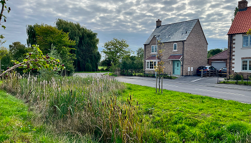
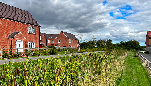
Residential Streets are the most common typology in most new street networks. These are quiet and attractive places to live and are safe and convenient places to walk, wheel and cycle, accommodating low levels of slow traffic. They are generally characterised by relatively narrow carriageways with kerb separated footways. They will always include SuDS and greenery and can accommodate on-street parking. To accommodate swales while minimising land take, it is permissible to include a footway on only one side of the street where traffic is low.
The character of Residential Streets will vary depending on Area Type:
The following sections and diagrams show typical arrangements and dimensions for Residential Streets:
The key design characteristics and requirements are as follows
| Carriageway Width (excluding cycle lanes) | Variable 4.8 m - 5.0 m (both ways) With occasional narrowing to 4.0 m |
|---|---|
| Verge | Optional Can be one side only Minimum width: 1.5 m min |
| Drainage | Mandatory SuDS - combination of:
|
| On-street parking | Optional If perpendicular, this must be on one side only Minimum width: 2.25 m (parallel) 6.0 m (perpendicular) |
| Cycle lane & buffer | Mandatory unless traffic is very low (typically where street serves <25 properties) Shared-use footway / cycleway 3.0 m (2-direction) Otherwise on carriageway |
| Pavement | Mandatory 3.0 m shared-use cycleway / footway - unless traffic is very low (typically where street serves <25 properties). Otherwise 2.0 m minimum. Can be one side if drainage runs along one side or if serving less than 25 dwellings |
| Central reservation, or island features | Optional irregular features E.g. Rain gardens or other SuDS, new or existing trees and greenery. |
| Design Speed (not limit) | 15 mph |
| Total adoptable corridor width (approximate) | 12.0 m - 18.0 m |
Continuous crossings should be provided on side streets (Residential or Tertiary)
The footway can be provided on one side only if a swale is provided, and the street serves <25 homes.
A 3.0 m wide combined cycleway footway must be provided unless traffic movements are very low - as a guide, this would be where the street provides vehicle access to fewer than 25 homes. Elsewhere cycling will be within the carriageway
Must include street trees every 8 to 20 m on one or both sides.
Trees can be provided in verges or in buildouts.
The following urban design characteristics are recommended:
This refers to the distance from the edge of the adopted highway (typically the back of the footway) to the front of the building line. In other words - the depth of the front garden or driveway.
The ratio between the width of the street between building fronts, and the height of the building (height:width)
A Rural, or Edge, Lane is rural and informal in character and would typically be used on the edge of settlements, or sometimes for connecting smaller settlements. They are normally a shared surface, with all users accommodated in the carriageway, but could also include a footway or combined footway and cycleway. They are normally access only for vehicles, and can be traffic free. The width will vary to allow informal parking and passing places. Homes will normally only be on one side of the street.
The following sections and diagrams show typical arrangements and dimensions for Rural, or Edge, Lanes:
The key design characteristics and requirements are as follows
| Carriageway Width (excluding cycle lanes) | Minimum 3.9 m Mandatory 2.25 m wide passing places if vehicle access required. |
|---|---|
| Verge | Optional Minimum width: 1.0 m |
| Drainage | Mandatory SuDS on far side of lane - combination of:
|
| On-street parking | Optional, irregular bays and passing places |
| Cycle lane & buffer | Not applicable |
| Pavement | Optional if serving ≤ 25 dwellingsMandatory if serving > 25 dwellings and includes vehicle access. 2.0 m minimum if provided, or optional 3.0 m wide cycleway / footway. |
| Central reservation, or island features | Not applicable |
| Design Speed (not limit) | 15 mph |
| Total adoptable corridor width (approximate) | 6.0 m - 9.0 m |
Must include regular street trees (8 to 20 m) in a verge or swale
Each passing place must be visible from the previous one and these must be 2.25 m (minimum) wide.
The following urban design characteristics are recommended:
This refers to the distance from the edge of the adopted highway (typically the back of the footway) to the front of the building line. In other words - the depth of the front garden or driveway.
Town Mews are narrow residential streets lined by homes, often to the rear of large houses. They are similar to the Shared Space, but more urban and formal in character and narrower. They can provide a through route, but this must be filtered to limit vehicle access. If parking is provided it should be in clearly delineated locations. The surface will be level, and shared, with no separate pavement. They can allow vehicles, or be fully pedestrian.
The following sections and diagrams show typical arrangements and dimensions for Town Mews:
The key design characteristics and requirements are as follows
| Carriageway Width (excluding cycle lanes) | 4.0 m - 5.0 m (no vehicle access) 5.0 m - 8.0 m (with parking) |
|---|---|
| Verge | Not applicable |
| Drainage | Optional
|
| On-street parking | Optional within carriageway |
| Cycle lane & buffer | Not applicable |
| Pavement | Not applicable |
| Central reservation, or island features | Optional irregular features E.g. SuDS |
| Design Speed (not limit) | 5 mph |
| Total adoptable corridor width (approximate) | 4.0 m - 8.0 m |
Homes fronting the street should, as a minimum, include a planted strip between the building and the edge of the adopted street.
Can include occasional trees and planting.
The following urban design characteristics are recommended:
This refers to the distance from the edge of the adopted highway (typically the back of the footway) to the front of the building line. In the case of Town Mews, this will be a shallow front garden or a planted strip level with the carriageway.
The ratio between the width of the street between building fronts, and the height of the building (height:width)
Cycle streets are designed for cycle and pedestrian access only. They provide segregation between cyclists and pedestrians on busy cycle routes, providing a safe and quiet environment for all users. They are filtered to prevent access for cars, but can also be designed to allow emergency access.
The following sections and diagrams show typical arrangements and dimensions for Cycling Streets:
The key design characteristics and requirements are as follows
| Carriageway Width (excluding cycle lanes) | Not applicable - Must be filtered to prevent access. |
|---|---|
| Verge | Not applicable |
| Drainage | Optional
|
| On-street parking | Not applicable |
| Cycle lane & buffer | Mandatory central cycle lanes
|
| Pavement | Mandatory on each side of the street. If homes only front one side of the street, then only one footway is required on that side. Minimum width 2.0 m |
| Central reservation, or island features | Optional separation between cycle lane and pavement Minimum widths:
|
| Design Speed (not limit) | Not applicable |
| Total adoptable corridor width (approximate) | 8.0 m - 10.0 m |
Segregation between the cycle track and pavement must be provided
Either:
If planting is used, regular gaps (every 10.0 m) must be provided to allow access to properties.
Homes fronting the street should, as a minimum, include a planted strip between the building and the edge of the adopted street.
The street can include a planting strip, or strips, to segregate the cycle track and footways
The following urban design characteristics are recommended:
This refers to the distance from the edge of the adopted highway (typically the back of the footway) to the front of the building line. In other words - the depth of the front garden or driveway.
As well as having an important movement function, junctions are places where people can meet and spend time. Key junctions are often a focus point, with taller landmark buildings, public spaces, amenities and activity. They are not just about moving vehicles as efficiently as possible.
Standard DMRB (Design Manual for Roads and Bridges) roundabouts must not be used, apart from on the trunk road network.
Junctions must be designed to accommodate all users, including walkers, wheelers and cyclists.
If the junction geometry results in left-over space, this must be used for greenery (including SuDS or trees) or public space. Excess paving or amenity grass should be avoided.
New junctions should be in accordance with the principles and palette of junction types below, or with any updated national best practice street design guidance. The following types are permitted:
For all junctions, designers should consider the surrounding context. Buildings should be used to define the junction, with frontages facing the junction and clear boundaries between public and private space.
Significant junctions, such as between two Type 1 – Principal Streets, or those and the centre of a development, are important focal points for a development and should incorporate the following placemaking characteristics:
Any junction could be designed to provide a green space or public square with planting and seating. This could have a formal or informal layout. This includes parking squares.
Large radii junctions are land hungry and less safe for all street users.
Smaller corner radii encourage slower, more careful driving and maintain pedestrian desire lines, reducing the width of carriageway that needs to be crossed. Most vehicles do not require large radii to turn, and those vehicles that do (such as refuse vehicles) only tend to use streets occasionally.
Junction radii must be as small as possible to ensure that the pedestrian desire line is maintained and that vehicles turn slowly. For Residential and Tertiary Streets, this should be less than or equal to 2.0 m.
Junctions must not be designed around large vehicles that would only use the junction occasionally (twice a day or less). In all streets outside of the trunk road network it is acceptable for large vehicles to take up both lanes when turning.
The only exception to this rule is on very busy streets where there are likely to be conflicts at peak times of the day.
Overrun areas should be used on junctions with a very acute angle, taken to be anything under 80°.
If larger radii (above 2.0 m) are unavoidable, then one of the following should be used:
As an alternative to larger radii, the minor arm of a junction (the side street) can be widened for the first 5.0 m to allow easier manoeuvring, while keeping the kerb radii low.
A range of junction typologies has been developed.
New junctions must be in accordance with the palette of junction types below.
At junctions, raised tables give pedestrians priority over the junction and require vehicles to slow and give way.
Raised tables must be constructed at the same level, and in the same material as the footway. If the footway is laid in the same material as the carriageway, a contrasting material must be used for the raised table.
Raised tables should be used on crossroad junctions where there is no stagger between streets (see below) to provide adequate traffic calming.
The carriageway could be narrowed at raised tables, ideally using street trees and other planting to reduce the crossing distance and help reduce vehicle speed as much as possible.
There is no need to continue the kerb line at raised tables junctions - it can be omitted
Raised tables can be any shape, including circular.
Most junctions between minor streets, and minor and major streets will be a crossroad, a T or a Y junction. Careful consideration needs to be given to staggering junctions on opposite sides of the street - a minor stagger between junctions is beneficial for traffic calming by breaking up forward visibility, and can be used to create vistas to key buildings, adding character. However, excessive staggers disrupt pedestrian desire lines and reduce permeability and need to be avoided.
Junctions on opposite sides of the road should not be excessively staggered. Ideally the maximum stagger should be no more than 10 m (measured back of kerb to back of kerb)
Where excessive junction spacing is unavoidable, mid-block pedestrian routes should be introduced, in the form of a mews or ginnell, to maintain permeability.
Crossroads, with no stagger, can be used and are encouraged. They should be used with raised tables to provide traffic calming.
Junctions are a natural place to create public spaces such as greens and public squares. These can also take the form of a circus (not to be confused with a roundabout) or a crescent.
Circuses must not be designed as a roundabout.
Squares, circuses and crescents should allow two-way traffic - they should not operate and a gyratory system.
Mini roundabouts provide some of the advantages of roundabouts but take up limited space. They can be safer than crossroads for pedestrians and cyclists where traffic volumes and speeds are low.
Mini roundabouts must only be used on Type 2 - Residential Streets and Type 3 - Tertiary Streets.
Mini roundabouts must not be used at junctions with more than four arms. They must only be used where a staggered arrangement is not feasible (i.e. as a replacement for crossroads).
The central island must be raised above the carriageway level, but must allow for vehicle overrun where required.
Where cyclists use the carriageway, the inscribed circle diameter (ICD) should not exceed 10.5 m.
The central island should be laid in a contrasting material to the carriageway.
The central island can include trees and other planting, providing that vehicle tracking is used to demonstrate swept paths for large vehicles.
The central island can be designed to an irregular shape to provide additional traffic calming.