Lincolnshire is one of England's largest and most historic counties, covering approximately 5,920 square kilometres. It comprises seven district councils in a two-tier structure. It stretches from Cambridgeshire and Northamptonshire in the south and from the River Trent in the west to the North Sea coast in the east. This extensive territory enjoys a remarkable range of landscapes: rolling chalk uplands in the Wolds; the wide and flat expanses of the Fens; the limestone ridge of the Cliff; and the coastal marshes fringing the Wash.
Along with the ancient city of Lincoln, the county is blessed with beautiful and historic market towns, including Stamford, Boston and Sleaford, that reflect centuries of agricultural prosperity. On the coast are the famous Victorian resorts of Skegness and Mablethorpe. Countless historic villages reflect the ancient patterns of settlement from Roman Britain onwards. Many place names reflect the county's prominent position within the Danelaw.
The county manages one of England's largest networks, comprising approximately:
The county faces significant growth pressures. The population of approximately 800,000 is currently projected to grow by 10% by 2041. Government requires districts collectively to deliver over 45,000 homes over the next decade to meet identified housing needs. Growth pressure is particularly acute near Lincoln and in settlements with good transport connections to larger centres.
The challenges of accommodating growth while protecting the county's distinctive landscape character and historic settlements are a central concern for councillors, officials and residents alike.
Lincolnshire's landscape has been fundamentally shaped by geology, hydrology, and centuries of human intervention. The county is dominated by two principal upland features: firstly, the limestone escarpment known as the Lincoln Cliff and, secondly, the chalk uplands of the Lincolnshire Wolds. The Lincoln Cliff runs north-south through the western part of the county. The Lincolnshire Wolds have been designated as a National Landscape, formerly an Area of Outstanding Natural Beauty. Between and around these elevated areas lie extensive lowlands, including the Clay Vale, the Trent Valley and fenlands to the south and east. The coastal zone comprises the distinctive grazing marshes, salt marshes and sandy beaches of the Lincolnshire coast. Much of the county's present character derives from systematic drainage and enclosure, which transformed former wetlands into some of England's most productive agricultural land.
Understanding these character areas is essential for ensuring that new development responds appropriately to local distinctiveness and contributes positively to the county's rich and varied landscape heritage. There are ten distinctive historic landscape character areas.
Area Types, as defined by the national Design and Placemaking Planning Practice Guidance, are intended to set standards across places that have common physical characteristics such as land use, density and housing types. They do not necessarily replicate what is proximate. For instance, towns and villages typically include multiple Area Types from a dense town centre core to suburban surrounds. They differ from character areas which have distinct physical characteristics linked to the locale, such as building materials, built form and architectural styles. There is, however, some inevitable overlap between an area type designation and character.
In the context of street design, the area type designation will impact geometry, parking typologies, and materials.
Larger sites will include multiple Area Types. Smaller sites will have a consistent area type that is appropriate for the type of site and local context. The latter will be agreed with the Local Planning Authority and Lincolnshire County Council during the pre-application processes.
Further guidance on using the Area Types is provided in Section A.5.1 Context and Character.
This code uses four Area Types:
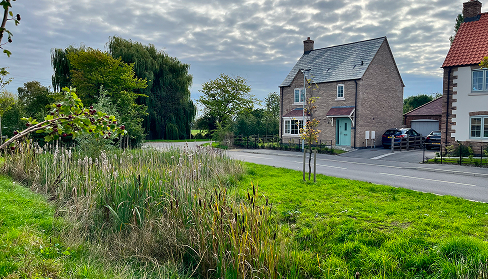
The village area type is typically lower density with a mix of detached homes and terraces with more on-plot parking. Streets are narrower and more informal. Examples include Harmston, Nettleham, Welton, Waddington and Metheringham.
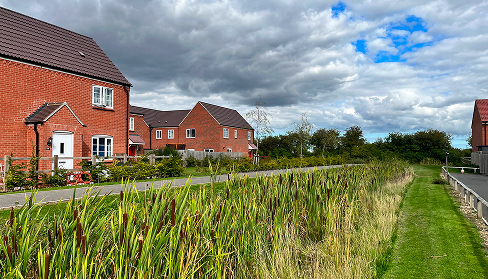
The suburban area type is slightly higher density with a mix of detached and semi-detached homes, terraces and small blocks of flats. Most streets will be wider and more formal in character. Examples include North Hykeham, Birchwood (Lincoln), Grantham eastern neighbourhoods, Sleaford's Greylees development and Quarrington.
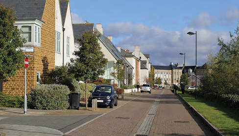
This area type is intended for the heart of larger developments or for smaller sites within town centres. Most buildings will be terraces or flats, with a mix of commercial and residential uses. Streets will be more formal normally with rectilinear blocks. Examples include Boston town centre, Grantham town centre, Spalding town centre and regeneration or mixed-use areas such as Lincoln Cornhill Quarter.
This area type is reserved for historic town and city centres where heritage considerations predominate. This will call for better quality, contextual materials and street furniture. Examples include Lincoln Cathedral Quarter and Uphill Lincoln, Stamford town centre, Louth town centre, Horncastle and Market Deeping